Photo: Jody Ray, the MBTA’s assistant general manager, pointing to the Brighton Street crossing.
In a significant concession to help push a final decision on a preferred route for the Belmont segment of a 102-mile bike trail, representatives from the MBTA and the state’s Department of Transportation said they could support a community path along either the north or south side of the commuter rail tracks from the Cambridge town line to Belmont Center.
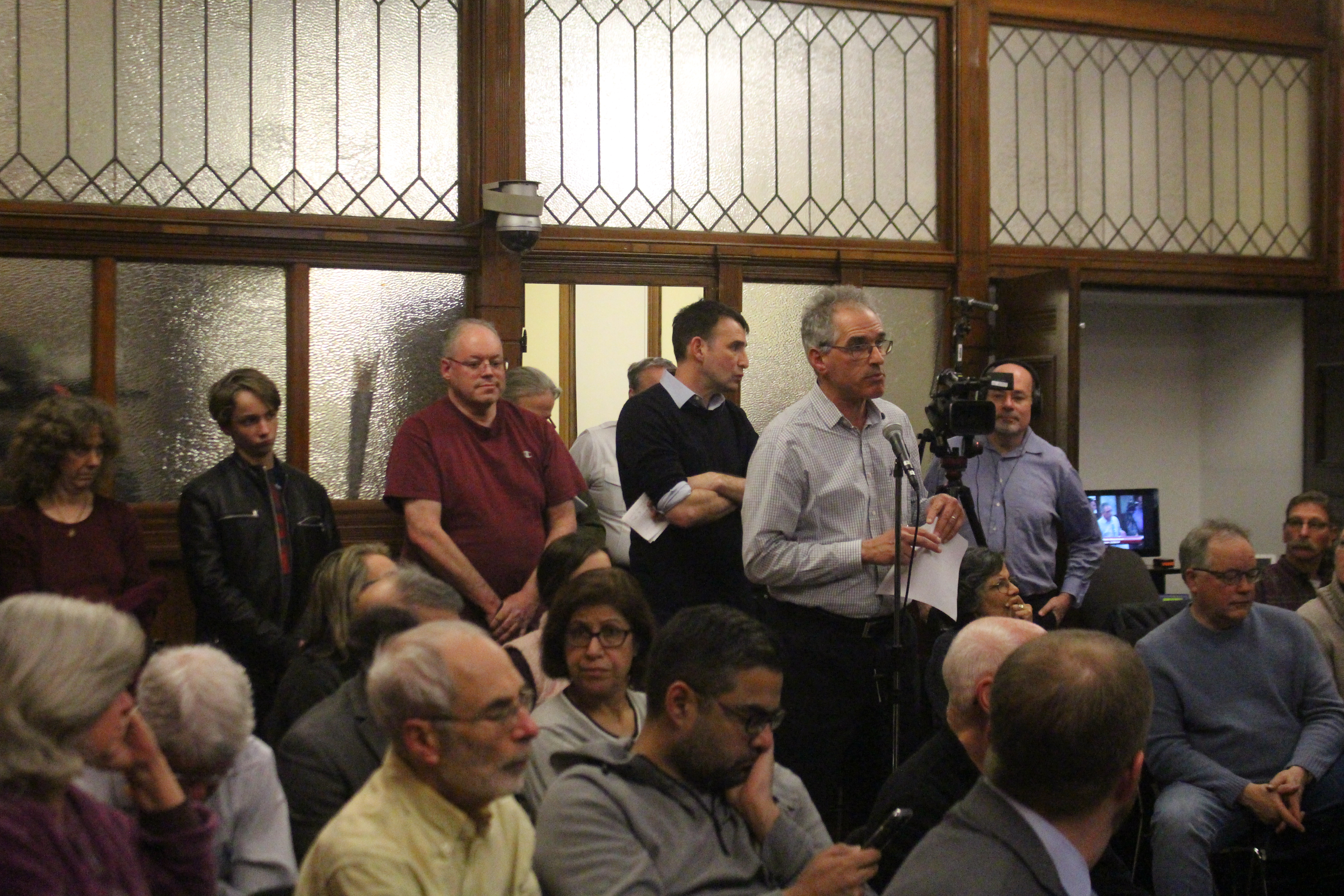
At a standing room only Board of Selectmen’s meeting on Monday night, Jan 28, the two officials whose statements this past summer highlighting safety concerns at the commuter rail crossing on Brighton Street pushed Selectmen to revisit a north route to the consternation of Channing Road residents, noted their agencies consider the path a “high priority” and want to keep the project moving forward.
When asked by Selectman Tom Caputo if both potential routes “were both fundable,” Jody Ray, the MBTA’s assistant general manager for Commuter Rail, said while the authority’s focus is on safety, “there’s no fatal flaw” for either a north or south path if a fix could be developed for the Brighton Street crossing.
But while the declarations would appear to allow the path to proceed along a southern route as the board decided more than a year ago, the reemergence of problems with several “pinch” points along the first several hundred feet of the southerly path could eventually keep the route on the north side.
At meeting’s end, the Selectmen circled Monday, Feb. 25 as the date when it will declare which of the two routes – north or south – will be selected, a decision more than three decades in the making.
At the Monday meeting, Belmont Town Administrator Patrice Garvin said Belmont would be seeking the maximum $300,000 from the Massachusetts Department of Transportation’s MassTrails Grants program, to be used for project development and design. Those monies will either supplement or defray the $1 million in Community Preservation Committee funds approved by Town Meeting in May. With a Feb. 1 deadline looming, the town would need to submit a plan that selected either one of the two routes.
Ray and Michael Trepanier from the state’s Department of Transportation were asked by the board to attend the meeting to provide their view on which path option would receive a more favorable reading.
The Board of Selectmen voted in Dec. 2017 to adopt the recommendation of PARE Consultants to build a pedestrian tunnel at Alexander Avenue and proceed along the south or High School side of the commuter rail tracks.
But that decision is now in “flux” according to Selectman Mark Paolillo, due to “serious safety concerns” the MBTA presented to the town’s attention in July that bicyclists would cut diagonally from the south side across the rail/road intersection at Brighton Street to engage the existing bike trail to Alewife Station. At the time, town and Belmont’s elected officials were told the state would be “reluctant” to fund a southern route.
In addition to the safety concerns, the MassDOT declared it would no longer require funding for the Alexander pedestrian tunnel to be linked with a south path. With the changes, town officials and elected officials determined the town should pursuit a north route, to the frustration of several Channing Road homeowners who have long complained of a lack of privacy and personal safety with a well-traveled trail.
Ray and Trepanier were asked to speak at the meeting as many residents sought a direct answer from the state and MBTA.
The DOT’s Trepanier put his cards on the table early: the state wants the Belmont section built as it will connect other sections and Belmont has committed sizable funds for design and feasibility studies to the project.
“A high priority corridor”
“The state recognizes this is the Belmont portion of the Mass Central Rail Trail, a high priority corridor for us working at the state level,” said Trepanier which will impact if the project is selected for a grant. But he said that if the MBTA’s issues with bicyclists safely cross the rail tracks at Brighton Street – cyclists would likely travel diagonally across the tracks rather than at crosswalks or sidewalks and would not encounter the safety gates when they close as a train approaches – were not resolved than possible future funding would be “negatively impact the favorability” of the project.
“Bicyclists don’t tend to make right corner turns, they’ll take the shortest distance” which is hazardous when a train is approaching, Ray said.
Since the MBTA wanted gates to prevent residents from going into the crossing, Selectman Paolillo suggested a system in which additional gates onto the path to cutting all access to the intersection which incidentally is being discussed for an intersection in West Concord.
When asked by Selectmen Chair Adam Dash if such a design addition – which Trepanier called “a really innovated thing to do” – would change the MBTA’s concerns on the southern route, Ray said while the authority always wants a crossing away from the tracks, “we will consider it.” And Trepanier said, “the caveat would be that we’d want … to engage in national best practices on how we deal with these hazardous locations.”
But Trepanier added there needs to be some “amount of practicality and pragmatism inject here” and while the MBTA had “raised the red flag” on their safety concerns, “we recognize people can [cross at an angle] today. The path is there and we don’t want to exacerbate a safety issue because one fatality is a fatality too many.”
“There are details like this that need to be worked out in order to ensure that working with a partner that we could assuage their concerns or make the situation safer,” said Trepanier.
While the state and MBTA may have softened their objection to a southern path, it also brought to the forefront an issue of “pinch points” along the start of the route from Brighton Street towards Belmont Center. While both trails need to contend with buildings and right of ways to have the required width that will allow access for emergency vehicles, a southerly route would require the town to take a portion of two sites, the Purecoat structure and the building housing the Crate Escape, a dog daycare business, through a sale or by an eminent domain taking.
In fact, the analysis of possible routes by the Pare Corp. which conducted a near year-long feasibility study of the community path did not take into consideration the price of acquiring portions of the two businesses. Amy Archer of Pare said she would begin a new study to reevaluate how much the town will undertake in the additional costs.
And the price tag for a southern route could be significant upwards to several millions of dollars, according to resident and path supporter Paul Roberts. Resolving the pinches will be “at least as daunting” as solve the safety problems at Brighton Street. He said there is no such impediment on the north side of the tracks; the only reason the board will not declare its preference for the route has less to do with safety or cost but as a political decision to placate the Channing Road homeowners.
But defenders of the southernly laid out path challenged the price differential by proposing using town streets including Hittinger Road to avoid the buildings altogether.
-
- State Sen. Will Brownsberger attended Monday’s meeting.

-
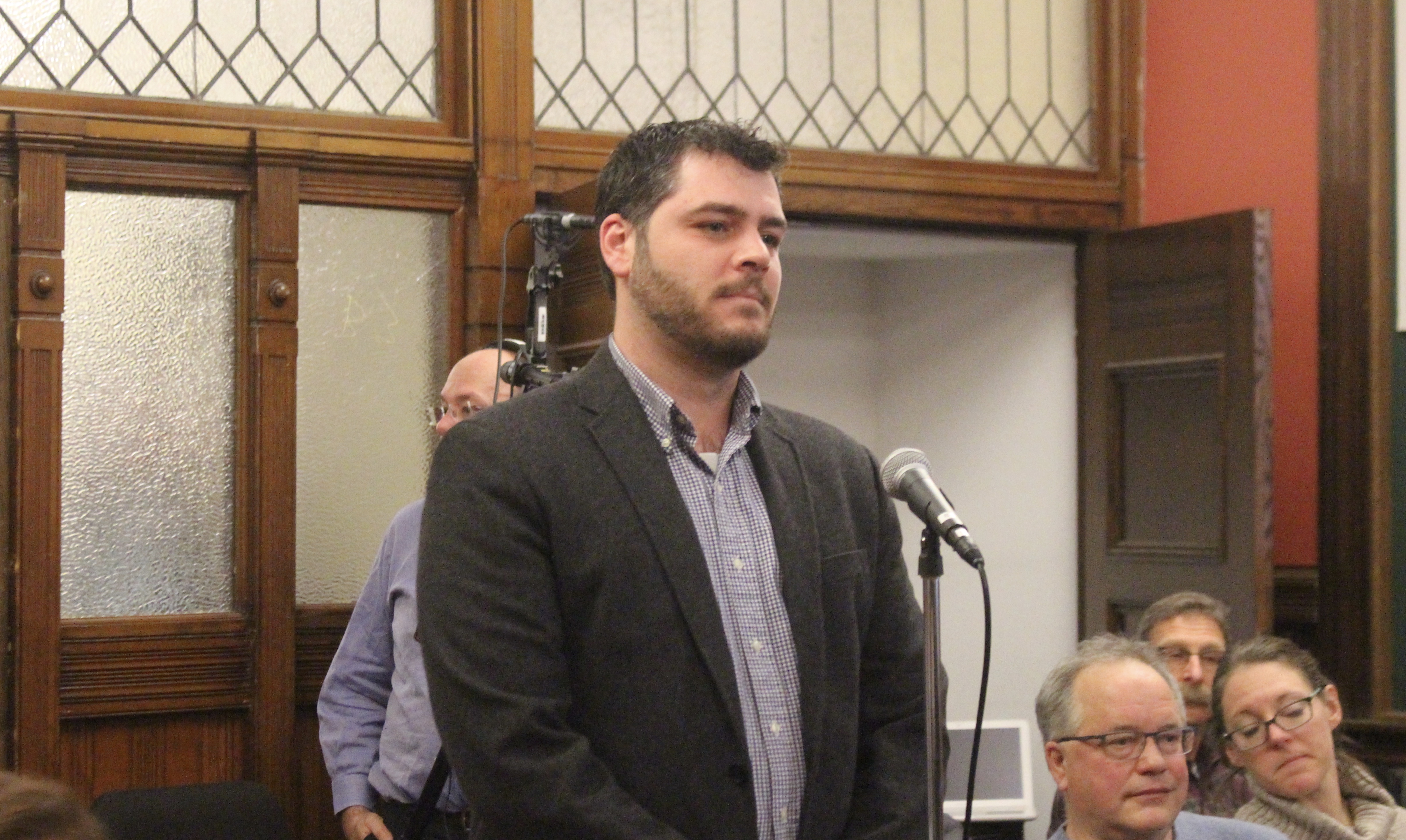
- Michael Trepanier from the state’s Department of Transportation.
-
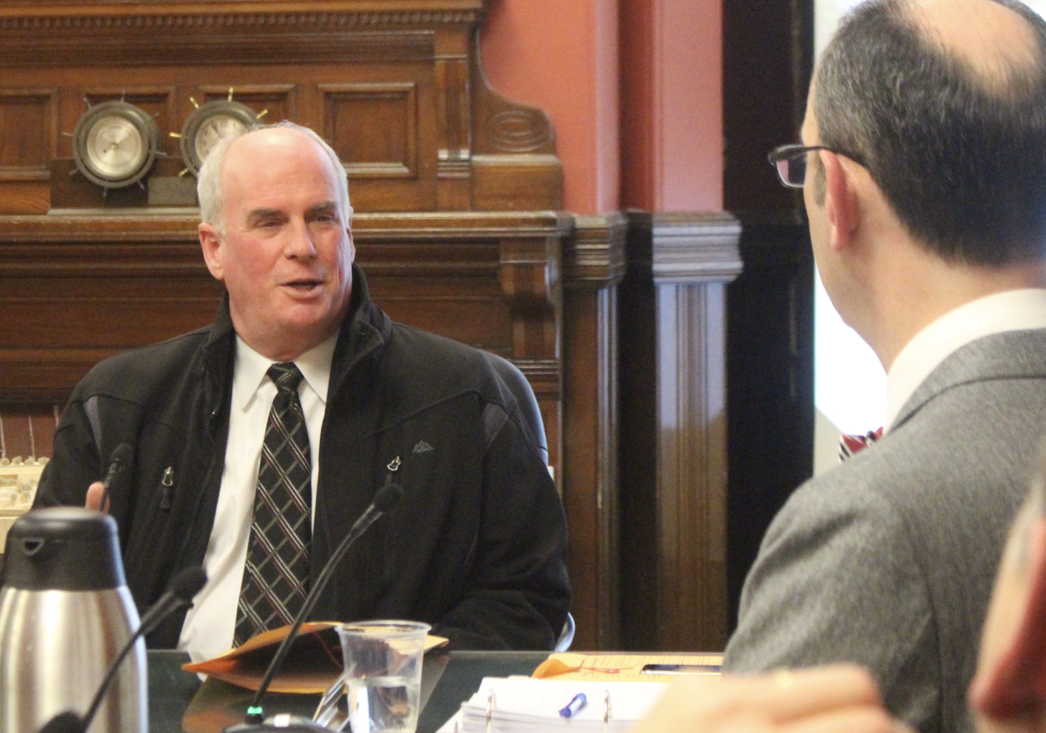
- Jody Ray, MBTA