Be Prepared For Tuesday’s Nor’easter With Important Belmont Safety Numbers

Photo: Get ready for a parking ban on Tuesday.

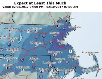
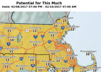
If you thought you wouldn’t need to use the snow shovel or salt on the sidewalk this warmer-than-usual winter, you would be in for a rude surprise on Tuesday morning as an old-fashioned nor’easter will slam into Massachusetts, according to the National Weather Service, which has issued a Winter Storm Warning for most of the region.

For Belmont residents, Tuesday will be about parking restrictions and having town resources close at hand.

“A significant winter storm will continue impacting the Southern Rockies and High Plains today before turning northeast and aiming for the Northern Mid-Atlantic, New York, and New England early this week,” said an NWS press release sent out at 3 a.m. Sunday, Feb 11.

“Heavy snow is possible. Total snow accumulations of 4 to 8 inches are possible. Winds could gust as high as 40 mph,” predicts the NWS on Sunday. The storm will start late Monday night and last through late Tuesday night. The hazardous conditions could impact the morning or evening commute.

Residents should expect the Belmont Police to issue a Snow Emergency Parking Ban just before the storm arrives. During the ban, vehicles parked on town roadways, and in municipal and Belmont Public School parking lots will be towed at the owner’s expense.

Residents should visit the town’s website for information on winter weather and the snow removal bylaw.

With high winds expected, there is a possibility power to residences will be impacted. Residents should contact Belmont Light to report outages – do not call 911 unless it is a true emergency.

  • Call Belmont Light at 617-993-2800 to report an outage.
  • To text an outage report, message your information to 617-993-6006 (message and data rates may apply) with your name, address, and outage information. 

Winter Storm Warning For Belmont: 5″ to 8″ Of The White Stuff On Friday

Photo:

Belmont and communities inside the Route 128 corridor are under a Winter Storm Warning as between five to eight inches of snow is expected on Friday, Jan. 7.

The warning, issued at 3:24 a.m., Thursday, Jan. 6 by the National Weather Service, forecasts heavy snow from 1 a.m. to 7 p.m. in portions of eastern and southeastern Massachusetts and Rhode Island.

Travel could be very difficult, warned the service, as hazardous conditions could impact the morning or evening commute.

“If you must travel, keep an extra flashlight, food, and water in your vehicle in case of an emergency,” reads the press release. The latest road conditions for the state can be obtained by calling 511.

Belmont Under Winter Storm Warning ‘Til Tuesday Afternoon

Photo: Snow storm heading Belmont’s way

Upwards to a foot of snow is set to fall on Belmont and the rest of Massachusetts beginning Monday, Feb. 1 as the state has been placed under a winter storm warning by the National Weather Service.

Residents should anticipate the town issuing a snow emergency parking ban for all roadways and municipal and Belmont Public School parking lots.

Issued at 3:37 p.m., Sunday, Jan. 31, the Service’s Boston office is predicting heavy snow of between 7 to 15 inches with wind gusts as high as 45 mph. The storm is anticipated to begin 10 a.m. Monday with the heaviest precipitation Monday afternoon and evening. It’s expected to pass through the region Tuesday after noon.

Traveling will be “very difficult to impossible” in the many parts of the state as hazardous conditions could impact the morning or evening commute, said the Service. Gusty winds could bring down tree branches and may increase the risk for power outages, in addition to the gusty northeast winds.

If you are experiencing an outage, call Belmont Light’s Outage hotline at 617-993-2800. Do not call 911.

First Winter Storm Brings Snow, Rain Through Tuesday; Schools Still Open Monday

Photo: A snowy return from the Thanksgiving break.

Monday and Tuesday’s morning commutes will be trying for commuters and students as Belmont prepares for the first winter storm of the season which begins late Sunday evening, Dec. 1.

Belmont is under a Winter Storm Warning which will last until 7 a.m. Tuesday, Dec. 3. Belmont currently lies on the line of 6 to 8 inches and 8 to 12 inches of snow according to the latest map from the National Weather Service Boston.

As of 6 p.m. Sunday, Belmont schools will open on Monday.

In a 4 p.m. Sunday update from the NWS, heavy accumulating snow will come in two parts:

  • First part beginning at 5 p.m. Sunday through just after midnight Monday, Dec. 2, with the heaviest snow north of the Mass Pike;
  • The second part will begin Monday night into Tuesday morning, with greater snowfall in eastern Massachusetts.

A mix of freezing rain and sleet along with light snow will fall during the day Monday.

Blizzard To Blitz Belmont Tuesday, Causing Commuter Chaos During Whiteout Conditions

Photo: Good luck going out.

Near blizzard conditions will envelop Belmont beginning shortly before midnight and last for nearly 24 hours as a late winter nor’easter will sock the region with 10 to 18 inches of snow and sustained winds that could lead to power outages and tree damage to personal property.

The National Weather Service issued a Winter Storm Warning at noon, Monday, March 12 that would take effect from 11 p.m. Monday and last until 8 p.m. Tuesday, March 13. 

The service noted the near blizzard conditions in eastern Massachusetts will result in blowing and drifting snow. 

According to the NWS, a blizzard is a severe snowstorm characterized by strong sustained winds of at least 35 mph and lasting for a prolonged period of time, typically three hours or more.

The service said travel will be very difficult, especially during the Tuesday morning commute when snowfall rates of 1 to 3 inches per hour are possible. The Tuesday afternoon commute is also expected to be impacted. If you must travel, keep an extra flashlight, food, and water in your vehicle in case of an emergency.

Belmont Shuts Down Thursday As Major Storm Arrives – But Trash Will Be Picked Up!

Photo: It’s coming!

Belmont will effectively shut down for the entirety of Thursday, Jan. 4, as the region will be hit by what some are calling a “bomb cyclone” or what most New Englanders still describe as a good ol’ Nor’easter.

The National Weather Service issued a Winter Storm Warning at 4:29 p.m. Wednesday, Jan. 3 that will be in effect from 1 a.m. Thursday to 1 a.m. Friday, Jan. 5. Snow will be heavy and winds will be steady at 20 mph with gusts reaching 40 mph. 

In terms of timeline, the snow will begin in the early morning hours of Thursday, continuing throughout the day. The worst of the storm will occur from noon until 6 p.m. when most of the snow will be on the ground.

How much? Depending on what media source you decide is credible predicting the weather, from 8-12 inches (Globe), 9-13 from the NWS or 18 inches (Patch).

And Belmont will be shut down tight for the “bomb”: 

  • Belmont Public Schools will be closed on Thursday.
  • Town buildings will be closed.
  • There will be a SNOW EMERGENCY PARKING BAN in Belmont on all roadways and Municipal parking lots including schools effective at 6 a.m. on Thursday, Jan. 4 until further notice. All vehicles parked in violation of the ban will be towed at the owner’s expense.
  • Belmont Public Library and the Benton Library will be closed
  • Trash and recycling will be picked up as scheduled on Thursday.

If residents have any questions, they should call the snow emergency hotline at 617-993-2698.  

Snow Again: Gusty Blizzard on Tap for Sunday Evening/Monday

Photo: Snow? Again?

The National Weather Service Sunday morning, Feb. 12, has issued the second winter storm warning in three days lasting until 7 p.m., Monday, Feb. 13.

The storm will be the second nor’easter since Friday’s whiteout which brought nine inches of snow over eight hours on Thursday, Feb. 9. 

The NWS is predicting snow between 10 to 14 inches over 36 hours beginning at 1 p.m., Sunday. 

The NWS forecast includes:

  • Heavy snow with accumulations of 4 to 12 inches.
  • Steady snow will begin around noon Sunday then heavy in the afternoon into Monday, ending in the late afternoon Monday.
  • Hazardous travel due to snow covered roads and reduced visibilities. Blowing and drifting snow is possible.
  • Winds will be out of the west 10 to 20 mph with gusts up to 50 mph.

February Nor’easter Blowing into Belmont Thursday AM, Lasting All Day

Photo: You know the drill.

A good ol’ Nor’easter will dump between four inches to a foot of snow in Belmont all-day Thursday, Feb. 9.

At 10 a.m. today, Wednesday, Feb. 8, the National Weather Service issued a Winter Storm Warning for eastern Massachusetts including Belmont from 6 a.m. Thursday, Feb. 9 to midnight, Friday, Feb. 10.

Here are the details from the NSW:

  • Heavy snow with accumulations between 4 to 12 inches.
  • Snow will begin early Thursday morning and last through much of the day before ending Thursday evening. 
  • Snow could fall heavy at times and impact both the morning and evening commutes.
  • Hazardous travel due to snow covered roads and poor visibilities. Blowing and drifting snow is possible.
  • Winds will be out of the North 20 to 30 mph with gusts up to 50 mph.

The NWS provided a pair of maps relating to the amount of snow that we can expect to be shoveling. See below. 

screen-shot-2017-02-08-at-1-26-25-pm screen-shot-2017-02-08-at-1-26-51-pm

Belmont Under Winter Storm Warning; Phone Number to Have Close at Hand

Photo: At least it’s taking place on Saturday.

Belmont will see anywhere between six inches to a foot of snow by midnight, Sunday, Jan. 8, according to the National Weather Service.

At 11:40 a.m., Saturday, Jan. 7, the NSA issued a Winter Storm Warning that will remain in effect until 1 a.m. on Sunday, Jan. 8. Snow will fall moderately to heavy at times into the early evening hours before tapering off around midnight with gusty winds that could reach 35 mph.

Here are the phone numbers and information that you should keep close during the storm:

Belmont’s SNOW EMERGENCY HOTLINE: 617-993-2698.

Belmont Light’s Outage Line617-993-2800.

See winter storm information from the Department of Public WorksWinter Weather Brochure

Snow Removal Bylaw:

Be Prepared as Wintery Blast Coming to Belmont on Monday

Photo: Belmont, after the snow.

The National Weather Service has issued a Winter Storm Warning for Belmont and Eastern Massachusetts that will be in effect all day Monday, Feb. 8 and ending during the morning commute Tuesday. 

The service is predicting between six to ten inches of snow to fall in the region, becoming most intense between 8 a.m. and into the early afternoon accompanied by high winds blowing steady between 15-25 mph with gusts hitting 40 mph.

Traveling will be slow at best on well-treated roads and challenging on unplowed or untreated surfaces.

Here are a couple of phone numbers you should have on hand:

Belmont’s SNOW EMERGENCY HOTLINE: 617-993-2698.

Belmont Light’s Outage Line617-993-2800.

Here is winter storm information from the Department of Public Works that you can print out or download to your computer or phone: Winter Weather Brochure

Snow Removal Bylaw: