Latest Nor’easter Update: Yup, A Big, Bad Blizzard Heading to Belmont

Batten down the hatches, Belmont. A blizzard’s heading’ this way.

The latest information from the National Weather Service, released at 3:53 a.m. this morning, Monday, Jan. 26, is predicting snow accumulations of “around 20 to 30 inches with locally higher amounts.” This nor’easter could match the 27.1 inches of snow that hit Boston in the famous Northeastern United States blizzard of 1978. 

“Those venturing outdoors may become lost or disoriented … so persons in the warning area are advised to stay indoors,” warned the NWS as it issued a Blizzard Watch for the eastern part of the state and region.

While the storm is expected to begin late today and linger into early Wednesday, the worst of the storm will be tonight, Monday, Jan. 26 through Tuesday afternoon, Jan. 27.

And once it starts, the heavy snow – falling Tuesday morning up to 2 to 4 inches an hour – and strong winds will result in white-out/blizzard conditions with near zero visibility.

Winds will be out of the north-northeast at 15 to 25 mph with gusts around 65 to 75 mph with the worst of the winds coming late tonight, Monday, into Tuesday.

“Travel will be impossible and life threatening across the entire region. Also snow may be wet enough to result in downed tree limbs and power outages in addition to the winds,” reported the NWS.

The National Weather Service is advising resident that all unnecessary travel is discouraged beginning after Monday’s commuter rush to allow people already on the road to safely reach their destination before the heavy snow begins and to allow snow removal equipment to begin to clear roads.
Historic Nor’easter Blowing into Belmont From Monday Evening Through Tuesday Night

A massive Nor’easter will blow into Belmont and the region beginning Monday night and lasting for 24 hours, bringing up to two feet of snow along with blizzard conditions that will make travel dangerous.

“This has the potential to be a historic storm,” noted the National Weather Service in Taunton which issued the Blizzard Warning at 12:34 p.m. on Sunday, Jan. 25.

The NWS forecast calls for continuous heavy snow and strong winds between 20-to-30 mph with gusts of up to 60 mph to produce whiteout conditions with considerable blowing and drifting snow with the worst of the storm occurring between Monday night, Jan. 26 through Tuesday afternoon, Jan. 27.

The snow may be wet enough to result in some downed tree limbs and power outages. Travel may become impossible and life threatening across the entire region as temperatures will stay in the low 20s.

Snowy Saturday: Winter Storm Watch Issued for Belmont

Snow in January? Don’t panic!

The National Weather Service in Taunton has issued a Winter Storm Watch for Belmont and most of the western suburbs of Boston, for most of Saturday as heavy snow is expected to fall on the region.

As of 4 a.m., the NWS is predicting between 4 to 8 inches of snow with a trace of ice starting in the wee hours of Saturday, Jan. 24. The precipitation may change to rain mid-day before changing back to snow for the evening.

Belmont is likely to be on the lower end of the snow fall projections as Boston and Somerville are expecting only 3 to 5 inches due to warmer costal weather.

Because the snow will be wet, large branches and wires could be brought down.

And don’t fly your private plane as visibility will be a quarter mile or less at times.


Burrrrr: Bundle Up Tonight as Temps Will Feel 24 Degrees Below Zero

It’s gonna get cold tonight. Dangerously so.

The National Weather Service issued a Wind Chill Advisory at 4 a.m. cautioning residents that bitterly cold wind chills that will feel like – 24 degrees from 5 p.m. today, Wednesday, Jan. 7 to 10 a.m. on Thursday, Jan. 8.

“Dangerously cold wind chills will result in frostbite or hypothermia if precautions are not taken,” says the advisory.

Winds will pick up during the day and reach between 10 to 20 mph with gusts up to 35 mph with temperatures ranging from 5 to – 5 degrees.

“If you are heading outdoors, dress in layers and wear a hat and gloves,” notes the advisory.


Clay Pit Pond Breaks Bank, Street Ponding on Concord, Common

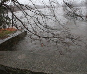
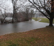
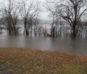
Clay Pit Pond has breached its banks in two locations while several main streets in Belmont have become rivers themselves as a late autumn Nor’easter hammers the East Coast.

At 4:45 p.m., an Underground Weather station in Cushing Square reported 3.1 inches of rain falling since midnight. The National Weather Service has issued a flood warning for the area until tonight.

“We are having issues around town,” said Belmont Police Sgt. David Sullivan, the Night Shift Supervisor.

“There has been individual places where there has been flooding and sewage backups,” Sullivan said.

Water has advanced a few feet from the access road near the Field House parking lot at Belmont High School while the pond has swamped the low-lying area near the corner of Underwood and Hittinger streets, the location of the start of Belmont’s cross country course.

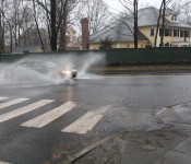
Nearby, Concord Avenue from the Cambridge line to the MBTA commuter line station at Belmont Center and Common Street at Dunbarton Road is experiencing “street ponding” where water has accumulated due to the rapid rainfall.

Light Icing Monday Night/Tuesday AM; Then the Deluge for Belmont

First ice, then lots and lots of water.

No, it’s not the first steps in making a cocktail but the spate of nasty weather – ice, rain and wind – Belmont residents will face for the next day and a half.

At 3:21 p.m., the National Weather Service issued a Winter Weather Advisory that begins at 7 p.m. tonight, Monday, Dec. 8 until 5 a.m., Tuesday, Dec. 9 that will result in a minor accumulation of ice and snow on roadways and sidewalks.

The conditions will result in “slower than normal travel” due to the slippery road conditions.

“Drivers should allow extra time and be especially careful on bridges and overpasses,” the NWS suggests.

By Tuesday morning, heavy rains – between one-and-a-half to two inches with some areas receiving up to four inches – and strong winds will arrive for most of the day with the likelihood of flooding and street ponding (when water pools at low points in the roadway, generally as a result of inadequate drainage or improper grading) in areas around town. The winds, steady at 15 to 25 mph with gusts up to 50 mph, will cause some trees and branches to fall and may lead to power outages.

If you power does go out, call Belmont Light at 617-993-2800. Do not call 911 unless it’s a true emergency.

The heaviest rain and strongest winds will occur during the evening rush hour on Tuesday.

Nor’easter on Thanksgiving Eve. That’s All You Need to Know

To hear and read the forecasts being bandied about for tomorrow, Thanksgiving Eve, one would believe the Boston region is teetering on the edge of the apocalypse due to the anticipation of the dreaded Nor’easter.

“Nor’easter Likely To Bring Thanksgiving Travel Chaos to Northeast” shouts the headline from a national broadcasting corporation.

“Expectations for an approaching nor’easter have shifted, threatening up to 4 inches of snow accumulation as far east as Boston” warned a big Boston daily newspaper.

“Thanksgiving storm: Hour-by-hour snowfall!” announced a local television station.

Lasciate ogne speranza, voi ch’intrate!

With so much information being dispensed on this weather “event” – check out your twitter account to see how all encompassing the storm has become – it appears that, yes, it will be stormy Wednesday afternoon.

The National Weather Service, as of 3:14 p.m., today, Tuesday, Nov. 25, issued a winter weather advisory from 7 a.m. Wednesday until 7 a.m. Thanksgiving as snow is coming into the area.

But an advisory is issued when the accumulation is expected to be “light.” And the latest information is that Belmont can expect to receive between three to six inches with a trace of ice.

Rain will start around daybreak and change over to a wintry mix of snow and sleet by mid-day and into the afternoon before changing to snow in the evening. It will be heavy at times and windy – from the north averaging 15 to 20 mph with gusts up to 40 mph –before tapering off on Thanksgiving morning, just in time for the annual Belmont-Watertown football match at 10 a.m., this year at Harris Field.

So be careful when driving on untreated roadways or on suspended roads – like bridges and overpasses – and sidewalks.

If the lights go out, call Belmont Light at 617-993-2800. 

So here is your take away for tomorrow’s nor’easter:

  • It will be snowy tomorrow especially in the evening and at night.
  • It will take much longer to travel on Wednesday so you’ll be on the smartphone to hear the latest from your family member/friend as they are stuck in an airport or on the Mass Pike.
  • You’ll need something essential for the Thanksgiving meal and will be driving through the storm anyway.
  • Where are the snow shovels?

Damaging Winds Blowing Into Belmont for the Afternoon, Night

The National Weather Service issued this morning a wind advisory for Belmont and the rest of eastern Massachusetts beginning at 3 p.m. and staying in effect until 10 p.m.

The big blow will see gusts up to 55 mph impacting the town during the afternoon, evening and a portion of tonight with sustained winds of 15 to 25 mph.

The expected gusts, accompanied by heavy rain, will be strong enough to knock down trees limbs and power lines, causing isolated power disruptions.

The heavy downpours will also cause isolated flash floods and areas of standing water.

If you experience an outage in Belmont, you are advised to called the town’s utility company, Belmont Light, at its outage line 617-993-2800. Do not call 911 unless it’s a true emergency.

Snow, Yes Snow, in the Forecast for Friday’s Commute in Belmont

Ugh.

The National Weather Service office in Taunton issued a hazardous weather outlook at 4:27 p.m. this afternoon, Thursday, Nov. 13 for eastern Massachusetts including Belmont forecasting a “moderate probability of an inch or two of snow” beginning after midnight, Friday, Nov. 14.

The resulting snow “may cause slippery travel during the Friday morning commute,” read the outlook.

The only good news: the temperature will stay above freezing overnight and into Friday until 10 p.m. Friday night.

Flash Flood Warning in Belmont Until 10 PM

Just before noon, Thursday, Oct. 16, the National Weather Service issued a flash flood warning for eastern Massachusetts including Belmont as torrential rains are expected to arrive in the area coinciding with the afternoon rush hour.

The warning will continue until 10 p.m.

Bands of heavy rain showers will deliver about one to two inches of rain in the afternoon and early evening, according to the NWS. There is a potential that some localized areas could see three to four inches in a short time period.

Be aware of areas that flood during these weather events. They include the Concord Avenue underpass of the commuter rail bridge in Belmont Center, areas of Waverley Street and along Common Street near the Wellington brook.